पटिमा:Map of USA MD.svg

Size of this PNG preview of this SVG file: २८६ × १८६ pixels. Other resolutions: ३२० × २०८ pixels | ६४० × ४१६ pixels | १,०२४ × ६६६ pixels | १,२८० × ८३२ pixels | २,५६० × १,६६५ pixels.
Original file (SVG file, nominally २८६ × १८६ pixels, file size: १६७ KB)
| This is a file from the Wikimedia Commons. Information from its description page there is shown below. Commons is a freely licensed media file repository. You can help. |
Clickable version
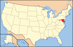
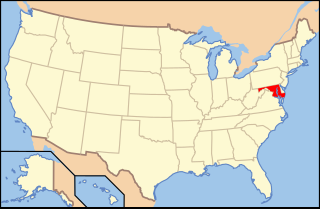
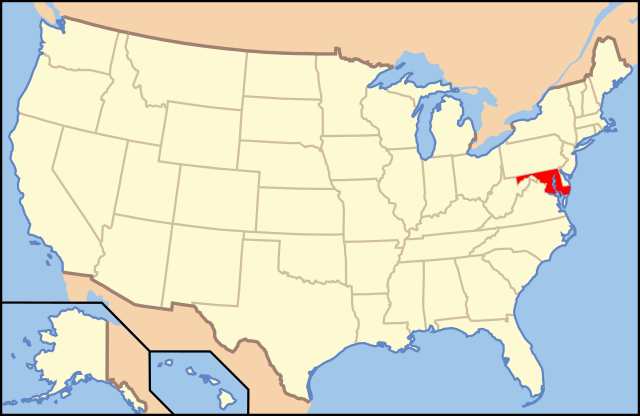
| Description | Map of USA with Maryland highlighted | ||||||||
| Date | see file history below. | ||||||||
| Source | Own work (Original text: own work by uploader, Own work based on: Map of USA without state names.svg) | ||||||||
| Author |
This version: uploader Base versions this one is derived from: originally created by Wapcaplet |
||||||||
| Permission (Reusing this file) |
This file is licensed under the Creative Commons Attribution 2.0 Generic license.
|
||||||||
| Other versions | Map of USA with state names.svg | ||||||||
| SVG genesis | This locator map was created with Inkscape. |

File history
Click on a date/time to view the file as it appeared at that time.
| Date/Time | Thumbnail | Dimensions | User | Comment | |
|---|---|---|---|---|---|
| current | १३:४२, १ नवम्बर २०१२ | | २८६ × १८६ (१६७ KB) | Kmusser | remove VA portion of eastern shore |
| ०९:०६, २६ अप्रैल २००८ |  | २८६ × १८६ (१६७ KB) | Rub1615~commonswiki | Reverted to version as of 07:11, 9 June 2006 | |
| १५:३२, २३ अप्रैल २००८ |  | २८६ × १८६ (१८३ KB) | Rfc1394 | Add an inset to the map enlarging the focus area to make it easier to see the designated state. | |
| ०७:११, ९ जून २००६ |  | २८६ × १८६ (१६७ KB) | Huebi~commonswiki | {{Information| |Description=Map of USA with Maryland highlighted |other_versions=image:Map of USA with state names.svg }} Category:Maps of the United States Category:Maps of Maryland Category:SVG maps {{GFDL-en}}{{cc-by-2.0}}{{cc-by-sa- |
File usage
The following page uses this file:
Global file usage
The following other wikis use this file:
- Usage on af.wikipedia.org
- Usage on ang.wikipedia.org
- Usage on an.wikipedia.org
- Usage on arc.wikipedia.org
- Usage on ar.wikipedia.org
- Usage on arz.wikipedia.org
- Usage on ay.wikipedia.org
- Usage on az.wiktionary.org
- Usage on bg.wikipedia.org
- Usage on bi.wikipedia.org
- Usage on bo.wikipedia.org
- Usage on bpy.wikipedia.org
- Usage on bxr.wikipedia.org
- Usage on ca.wikipedia.org
- Usage on ce.wikipedia.org
- Usage on cs.wikipedia.org
- Usage on da.wikipedia.org
- Maryland
- Annapolis
- Baltimore
- Towson (Maryland)
- Worcester County (Maryland)
- Allegany County (Maryland)
- Anne Arundel County
- Denton (Maryland)
- Frederick (Maryland)
- Oakland (Maryland)
- Cumberland (Maryland)
- Sharpsburg (Maryland)
- Hagerstown (Maryland)
- La Plata (Maryland)
- Rockville (Maryland)
- Baltimore County
- Frederick County (Maryland)
View more global usage of this file.