पटिमा:Map of USA AL.svg

Size of this PNG preview of this SVG file: २८६ × १८६ pixels. Other resolutions: ३२० × २०८ pixels | ६४० × ४१६ pixels | १,०२४ × ६६६ pixels | १,२८० × ८३२ pixels | २,५६० × १,६६५ pixels.
Original file (SVG file, nominally २८६ × १८६ pixels, file size: १६७ KB)
| This is a file from the Wikimedia Commons. Information from its description page there is shown below. Commons is a freely licensed media file repository. You can help. |
Clickable version
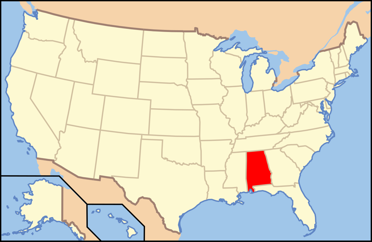
| Description | Map of USA with Alabama highlighted | ||||||||
| Source | United States (Outline Map) 1998 from Perry-Castañeda Library Map Collection: United States Maps | ||||||||
| Author | Huebi | ||||||||
| Permission (Reusing this file) |
This file is licensed under the Creative Commons Attribution-Share Alike 1.0 Generic license.
This file is licensed under the Creative Commons Attribution 2.0 Generic license.
This file is licensed under the Creative Commons Attribution-Share Alike 2.0 Generic license.
|
||||||||
| Other versions | image:Map of USA with state names.svg |

File history
Click on a date/time to view the file as it appeared at that time.
| Date/Time | Thumbnail | Dimensions | User | Comment | |
|---|---|---|---|---|---|
| current | ०७:५९, २७ मई २००६ | | २८६ × १८६ (१६७ KB) | Huebi~commonswiki | |
| १०:३०, २६ मई २००६ |  | ९५९ × ५९३ (३१० KB) | Huebi~commonswiki | {{Information| |Description=Map of USA with Alabama highlighted |other_versions=image:Map of USA with state names.svg }} Category:Maps of the United States Category:SVG maps {{GFDL-en}}{{cc-by-2.0}}{{cc-by-sa-1.0}}{{cc-by-sa-2.0}} |
File usage
The following page uses this file:
Global file usage
The following other wikis use this file:
- Usage on ab.wikipedia.org
- Usage on af.wikipedia.org
- Usage on ang.wikipedia.org
- Usage on an.wikipedia.org
- Usage on arc.wikipedia.org
- Usage on ar.wikipedia.org
- Usage on ay.wikipedia.org
- Usage on azb.wikipedia.org
- Usage on az.wikipedia.org
- Otoqa qraflığı (Alabama)
- Barbur qraflığı (Alabama)
- Batler qraflığı (Alabama)
- Bibb qraflığı (Alabama)
- Blaunt qraflığı (Alabama)
- Bolduin qraflığı (Alabama)
- Ballok qraflığı (Alabama)
- Cekson qraflığı (Alabama)
- Cefferson qraflığı (Alabama)
- Çembers qraflığı (Alabama)
- Çeroki qraflığı (Alabama)
- Çilton qraflığı (Alabama)
- Çokto qraflığı (Alabama)
- Dallas qraflığı (Alabama)
- DeKalb qraflığı (Alabama)
- Deyl qraflığı (Alabama)
- Usage on az.wiktionary.org
View more global usage of this file.